

Northeast India: Geography - UPSC Indian Physical Geography
Watch Video


Study smarter with Pi Lens
Get Notes, PYQs, Quiz and more for any Youtube video!
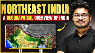
Northeast India: Geography - UPSC Indian Physical Geography
1 views

Defence Wallah CDS / AFCAT
Notes
Video Summary
Geography and Features of Northeast India
Northeast India, often referred to as the "Seven Sisters and One Brother," comprises Arunachal Pradesh, Assam, Nagaland, Manipur, Mizoram, Tripura, Meghalaya, and Sikkim. This region is characterized by its unique physical geography, rich biodiversity, diverse cultures, and significant economic activities. The area is known for its mountains, valleys, rivers, dense forests, and vibrant tribal traditions, making it a crucial part of India's physical and cultural landscape.
States and Regional Identity
The region consists of seven states—Arunachal Pradesh, Assam, Nagaland, Manipur, Mizoram, Tripura, Meghalaya—collectively called the Seven Sisters, with Sikkim often referred to…
Geography and Features of Northeast India
Northeast India, often referred to as the "Seven Sisters and One Brother," comprises Arunachal Pradesh, Assam, Nagaland, Manipur, Mizoram, Tripura, Meghalaya, and Sikkim. This region is characterized by its unique physical geography, rich biodiversity, diverse cultures, and significant economic activities. The area is known for its mountains, valleys, rivers, dense forests, and vibrant tribal traditions, making it a crucial part of India's physical and cultural landscape.
States and Regional Identity
The region consists of seven states—Arunachal Pradesh, Assam, Nagaland, Manipur, Mizoram, Tripura, Meghalaya—collectively called the Seven Sisters, with Sikkim often referred to as the "brother." These states are connected to the rest of India through the narrow Siliguri Corridor, also known as the "Chicken Neck." Each state has distinct geographical and cultural features, contributing to the region's diversity.
- Arunachal Pradesh: Easternmost state, first to receive sunrise in India.
- Assam: Known for the Brahmaputra River and tea plantations.
- Nagaland, Manipur, Mizoram, Tripura, Meghalaya: Hilly terrain, rich tribal culture.
- Sikkim: Mountainous, lifeline river Teesta.
Physical Features: Mountains, Valleys, and Plateaus
Northeast India's topography is dominated by the Eastern Himalayas, hill ranges, valleys, and plateaus. The region includes snow-covered peaks, deep valleys, and significant plateaus.
- Himalayan Region: Extends from Jammu & Kashmir to Arunachal Pradesh, including Sikkim. Features snow-capped peaks and glaciers.
- Eastern Himalayas: Found in Arunachal Pradesh and Sikkim.
- Purvanchal Hills: Eastern extension of the Himalayas, running from Arunachal Pradesh through Nagaland, Manipur, Mizoram, Tripura, and into Myanmar (where they are called Arakan Yoma and Pegu Yoma).
- Key Hills: Patkai (Arunachal Pradesh), Naga Hills (Nagaland), Mizo Hills (Mizoram), Lushai Hills, Khasi, Jaintia, Garo Hills (Meghalaya), Tripura Hills.
- Valleys and Plateaus:
- Brahmaputra Valley: Found only in Assam, formed by river deposition and erosion.
- Imphal Valley: Located in Manipur.
- Shillong Plateau: In Meghalaya.
- Karbi Anglong Plateau: In Assam.
River Systems and Drainage
The region's drainage is dominated by the Brahmaputra and Barak river systems, with several important tributaries and wetlands.
- Brahmaputra River: Lifeline of Northeast India, originates in Tibet (called Tsangpo), enters Arunachal Pradesh as Dihang, flows into Assam as Brahmaputra (also called Red River), and becomes Jamuna in Bangladesh.
- Barak River: Major river for Manipur, Mizoram, and Tripura; eventually joins the Ganga-Brahmaputra system.
- Key Tributaries: Lohit, Subansiri, Dhansiri, Manas, Dibang, Kopili.
- Teesta River: Lifeline of Sikkim, joins Brahmaputra.
- Wetlands:
- Loktak Lake (Manipur): Largest freshwater lake, features floating islands called "Phumdis" and the world's only floating national park (Keibul Lamjao), home to the Sangai deer.
- Dipor Bil (Assam): Important wetland, "bil" means lake in Assamese.
Forests, Vegetation, and Biodiversity
Northeast India is one of the most forested and biodiverse regions in the country, with a high percentage of land under forest cover and several biodiversity hotspots.
- Forest Cover: 60–70% of the region is forested; Mizoram has over 80% forest cover.
- Forest Types:
- Tropical Evergreen Forests: Found in Meghalaya, Mizoram, Arunachal Pradesh; one of three regions in India with this forest type.
- Semi-Evergreen and Moist Deciduous Forests: Found in Assam and Nagaland.
- Bamboo Forests: Widespread, supporting local handicrafts.
- National Parks (Assam): Manas, Dehing Patkai, Raimona, Orang, Kaziranga.
- Biodiversity Hotspot: One of four in India; home to species like the one-horned rhinoceros (Kaziranga), red panda (Sikkim), hoolock gibbon, clouded leopard.
- Rainfall: Highest in the world at Mawsynram and Cherrapunji (Meghalaya).
Climate Patterns
The climate of Northeast India is dominated by humid subtropical and tropical conditions, with significant variations due to altitude and geography.
- Humid Subtropical Climate: Found in higher altitudes (e.g., Tawang, Mechuka in Arunachal Pradesh), characterized by cooler temperatures.
- Tropical Climate: Found in lower plains (e.g., Assam), warmer and more humid.
- Rainfall: Mawsynram and Cherrapunji receive the world's highest rainfall, exceeding 1000 cm annually.
- Winters: Mild in plains, snowy in higher altitudes (especially Arunachal Pradesh).
Economic Activities and Occupations
Agriculture is the main occupation, supplemented by handicrafts, tourism, and oil extraction. The region's economy is shaped by its geography and resources.
- Agriculture: Main crops include rice, maize, millets, and pulses, especially in plains and flat areas.
- Tea Plantations: Assam is the largest tea-producing area; unique "tea garden time" was used to maximize daylight for workers.
- Jhum Cultivation (Shifting Cultivation): Practiced in hilly areas; involves slash-and-burn, cultivation until soil fertility declines, then shifting to new land (land rotation).
- Handicrafts: Bamboo-based crafts are prominent due to abundant bamboo forests.
- Tourism: Major income source, especially in hilly states; attracts visitors for natural beauty, wildlife, and tribal culture.
- Oil and Natural Gas: Assam has the oldest oil refinery in India (Digboi); oil extraction is a significant economic activity.
Culture, Tribes, and Languages
Northeast India is known as the "Land of Tribes," with immense ethnic and linguistic diversity. The region is home to hundreds of tribes and dialects, each with unique traditions.
- Ethnic Groups: Over 200 ethnic groups; more than 400 dialects spoken.
- Major Tribes: Nishi, Singpho, Khasi, Garo, among others.
- Cultural Diversity: The region's diversity is compared to the colors of a rainbow, with each state contributing to the overall vibrancy.
- Dance and Music:
- Bihu Dance: Assam; frequently asked in exams.
- Cheraw (Bamboo Dance): Mizoram; involves rhythmic bamboo movements.
- Wangala: Meghalaya; harvest festival celebrated after good agricultural yield.
- Food Habits: Rice is the staple food, with fish, bamboo shoots, pork, and herbs commonly consumed. Bamboo shoots are prepared by fermenting with spices.
- Religions: Hinduism, Christianity, Buddhism, and Animism (worship of nature, animals, and mountains) are practiced.
- Festivals:
- Hornbill Festival: Nagaland; named after the hornbill bird.
- Sangai Festival: Manipur; celebrates the Sangai deer, the state animal.
- Losar: Arunachal Pradesh; Tibetan New Year festival.
Wetlands and Unique Ecosystems
Wetlands play a crucial role in the region's ecology, supporting biodiversity and local livelihoods. The most notable wetlands are Loktak Lake and Dipor Bil.
- Loktak Lake: Located in Manipur, features floating islands (Phumdis) and the only floating national park (Keibul Lamjao), home to the endangered Sangai deer. Local communities build floating houses and practice fish farming on Phumdis.
- Dipor Bil: Located in Assam, serves as a significant wetland and biodiversity area.
Rainfall and Environmental Significance
Northeast India is globally significant for its rainfall and environmental richness. The region's forests and wetlands are sustained by heavy monsoons.
- Mawsynram and Cherrapunji: Receive the highest rainfall in the world, supporting dense forests and unique ecosystems.
- Environmental Importance: High rainfall and forest cover make the region a critical biodiversity hotspot and a key area for conservation.
Key Exam Takeaways
- The Seven Sisters (Arunachal Pradesh, Assam, Nagaland, Manipur, Mizoram, Tripura, Meghalaya) and Sikkim form Northeast India, connected by the Siliguri Corridor.
- The region is defined by the Eastern Himalayas, Purvanchal hills, Brahmaputra and Barak river systems, and significant plateaus and valleys.
- Brahmaputra is the main river, with its valley found only in Assam; Barak is important for Manipur, Mizoram, and Tripura.
- Loktak Lake (Manipur) and Dipor Bil (Assam) are key wetlands; Loktak features floating islands and the Keibul Lamjao National Park.
- Forest cover is among the highest in India, with tropical evergreen, semi-evergreen, and bamboo forests; Mizoram has over 80% forest cover.
- The region is a biodiversity hotspot, home to unique species like the one-horned rhinoceros, red panda, hoolock gibbon, and clouded leopard.
- Climate varies from humid subtropical in hills to tropical in plains; Mawsynram and Cherrapunji have the world's highest rainfall.
- Main occupations: agriculture (rice, maize, millets, pulses), tea plantations (Assam), jhum cultivation, bamboo handicrafts, tourism, and oil extraction (Digboi refinery).
- Over 200 ethnic groups and 400+ dialects; major tribes include Nishi, Singpho, Khasi, Garo.
- Key dances: Bihu (Assam), Cheraw (Mizoram), Wangala (Meghalaya).
- Staple foods: rice, fish, bamboo shoots, pork, herbs.
- Major festivals: Hornbill (Nagaland), Sangai (Manipur), Losar (Arunachal Pradesh).
- Religions: Hinduism, Christianity, Buddhism, Animism.
- The region's diversity and environmental richness make it vital for India's geography and culture.
Quiz
40 QuestionsClick on an option to find the answer
Question 1 of 40
Consider the following statements regarding the Great Himalayas:
The Great Himalayas consist of asymmetrical folds with a steep southern slope and a gentle northern slope. The range terminates at Nanga Parbat in the northwest and Namcha Barwa in the northeast.Which of the above statements is/are correct?
Solution
Both 1 and 2
Which one of the following regions of India are characterized by the presence of ‘shola forests’?
Solution
Western Ghats
The general direction of these ranges is from southwest to northeast. These ranges are dissected by fast-flowing rivers that are perennial with a high rate of fall and thus have the highest hydroelectric power potential in the country. These are inhabited by numerous ethnic tribal communities most of which practice Jhumming. Which of the following ranges has been described in the passage given above?
Solution
Arunachal Himalayas
Flashcards
5 CardsClick to reveal answerTap the card to see answer

