

Geography Mid Term Marathon 2026 - Class 9 ICSE Geography
Watch Video


Study smarter with Pi Lens
Get Notes, PYQs, Quiz and more for any Youtube video!
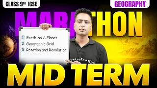
Geography Mid Term Marathon 2026 - Class 9 ICSE Geography
169 views

ICSE Wallah 9 & 10
Notes
Video Summary
Earth as a Planet
Unique Features and Position of Earth in the Solar System
Earth is the third planet from the Sun and the only known planet to support life. It is called the "Watery Planet" or "Blue Planet" because about 70-71% of its surface is covered with water, giving it a blue appearance from space.
- Solar System Members: Sun, 8 planets (Mercury, Venus, Earth, Mars, Jupiter, Saturn, Uranus, Neptune), natural satellites (moons), asteroids, comets, meteoroids, and meteorites.
- Earth’s Position: 3rd from the Sun, 5th largest in size among the planets.
- Life Support: Only planet…
Earth as a Planet
Unique Features and Position of Earth in the Solar System
Earth is the third planet from the Sun and the only known planet to support life. It is called the "Watery Planet" or "Blue Planet" because about 70-71% of its surface is covered with water, giving it a blue appearance from space.
- Solar System Members: Sun, 8 planets (Mercury, Venus, Earth, Mars, Jupiter, Saturn, Uranus, Neptune), natural satellites (moons), asteroids, comets, meteoroids, and meteorites.
- Earth’s Position: 3rd from the Sun, 5th largest in size among the planets.
- Life Support: Only planet with water in all three states and an atmosphere suitable for life.
Shape of the Earth: Geoid and Oblate Spheroid
Earth is not a perfect sphere or circle; it is described as a geoid or oblate spheroid. This means it is slightly bulged at the equator and flattened at the poles due to its rotation.
- Geoid: Earth-like shape, bulged at the equator, flattened at the poles.
- Oblate Spheroid: Technical term for Earth’s shape.
- Reason for Shape: Centrifugal force due to rotation pushes outwards at the equator, causing the bulge.
- Diameter Difference: Equatorial diameter is slightly larger than polar diameter.
Experimental Proofs of Earth’s Shape
Several observations and experiments confirm that Earth is not flat but curved.
- Sighting of a Ship: As a ship approaches from the horizon, the mast appears first, then the rest of the ship, indicating a curved surface.
- Bedford Level Experiment: Three poles of equal height placed at equal distances in a canal appear with the middle one higher when viewed from one end, possible only on a curved surface.
- Position of the Pole Star: The angle of elevation of the Pole Star decreases from 90° at the North Pole to 0° at the Equator, which is only possible on a curved surface.
- Satellite Images: Pictures from space show Earth as a curved, not flat, object.
- Lunar Eclipse: The shadow of Earth on the Moon during a lunar eclipse is always curved.
- Horizon: The visible horizon widens as one’s height increases, which would not happen on a flat surface.
- Sunrise and Sunset: Different places experience sunrise and sunset at different times, explained by Earth’s curvature.
- Circumnavigation: Magellan’s voyage around the world proved one can return to the starting point, possible only on a curved surface.
Earth as the Home of Mankind
Earth is uniquely suited to support life due to several favorable conditions.
- Optimal Distance from Sun: Average distance is about 149.6 million km, neither too close nor too far, allowing moderate temperatures.
- Average Temperature: About 17°C, suitable for sustaining life.
- Atmosphere: Composed of 78% nitrogen, 21% oxygen, and trace gases. Acts as a blanket, absorbs harmful rays, and maintains temperature.
- Ozone Layer: Absorbs harmful ultraviolet radiation.
- Water: Essential for life, moderates climate, and is available in all three states.
- Ecosystem and Biosphere: Interdependent system of living and non-living components; biosphere is the narrow zone where land, water, and air interact to support life.
Biogeochemical Cycles: Oxygen, Carbon, and Nitrogen Cycles
Earth maintains a balance of essential elements through cycles involving living and non-living components.
- Oxygen Cycle:
- Plants release oxygen during photosynthesis.
- Animals and plants use oxygen for respiration and release CO₂.
- Combustion and decomposition also use oxygen and release CO₂.
- Carbon Cycle:
- Plants absorb CO₂ for photosynthesis.
- Animals obtain carbon by eating plants.
- Respiration and decomposition return CO₂ to the atmosphere.
- Burning fossil fuels releases stored carbon as CO₂.
- Nitrogen Cycle:
- Atmospheric nitrogen is fixed by bacteria (Rhizobium, Azotobacter) into ammonia.
- Ammonia is converted to nitrites and nitrates by soil bacteria.
- Plants absorb nitrates; animals obtain nitrogen by eating plants.
- Decomposition and excretion return nitrogen to the soil.
- Denitrifying bacteria convert nitrates back to atmospheric nitrogen.
Geographical Grids: Latitudes and Longitudes
To locate places on Earth, a grid system of imaginary lines is used: latitudes (horizontal) and longitudes (vertical).
- Latitudes: Horizontal lines parallel to the Equator (0°), ranging from 0° to 90° North and South. Equator is the only great circle among latitudes.
- Longitudes: Vertical lines from North to South Pole, ranging from 0° (Prime Meridian at Greenwich) to 180° East and West. All longitudes are great circles.
- Grid Formation: Intersection of latitudes and longitudes forms a grid, allowing precise location identification.
Major Parallels and Heat Zones
Certain latitudes are significant for climate and sunlight distribution.
- Major Parallels: Equator (0°), Tropic of Cancer (23.5°N), Tropic of Capricorn (23.5°S), Arctic Circle (66.5°N), Antarctic Circle (66.5°S), North Pole (90°N), South Pole (90°S).
- Heat Zones:
- Torrid Zone: Between Tropic of Cancer and Tropic of Capricorn; receives direct sunlight, hottest.
- Temperate Zones: Between Tropics and Circles; moderate climate.
- Frigid Zones: Beyond Arctic and Antarctic Circles; coldest regions.
Calculation of Time Using Longitudes
Time differences across the globe are calculated using longitudes.
- Earth’s Rotation: 360° in 24 hours; 1° longitude = 4 minutes time difference.
- Local Time: Calculated based on the longitude of a place relative to the Prime Meridian (0°).
- Standard Time: Countries adopt a standard meridian for uniform time. India uses 82°30′E as the Indian Standard Time (IST), 5 hours 30 minutes ahead of GMT.
- International Date Line (IDL): Located at 180° longitude in the Pacific Ocean. Crossing IDL from west to east subtracts a day; east to west adds a day. The line is zigzagged to avoid dividing countries/islands into two different dates.
Motions of the Earth: Rotation and Revolution
Earth exhibits two main types of motion: rotation and revolution, each with distinct effects.
- Rotation: Spinning of Earth on its axis from west to east, taking approximately 24 hours (exact: 23h 56m 4.09s). Causes day and night.
- Axis Tilt: Earth’s axis is tilted at 23.5° from the perpendicular to the plane of its orbit, or 66.5° from the plane itself.
- Revolution: Movement of Earth around the Sun in an elliptical orbit, taking about 365 days 6 hours. Causes seasons.
- Leap Year: The extra 6 hours each year are added as one extra day every four years (February 29).
Effects of Rotation and Revolution
The combined effects of Earth’s rotation and revolution result in various phenomena.
- Day and Night: Caused by rotation; the side facing the Sun experiences day, the opposite side night.
- Sunrise and Sunset: Occur at different times at different longitudes due to rotation.
- Coriolis Effect: Due to rotation, moving air and water are deflected to the right in the Northern Hemisphere and to the left in the Southern Hemisphere.
- Seasonal Changes: Due to revolution and axial tilt, different parts of Earth receive varying sunlight during the year, causing seasons.
- Solstices and Equinoxes:
- Summer Solstice (June 21): Longest day in Northern Hemisphere; Sun is vertical over Tropic of Cancer.
- Winter Solstice (December 22): Shortest day in Northern Hemisphere; Sun is vertical over Tropic of Capricorn.
- Equinoxes (March 21, September 23): Day and night are equal; Sun is vertical over the Equator.
Great Circles and Navigation
Great circles are the largest possible circles on the surface of a sphere, important for navigation.
- Equator: Only latitude that is a great circle.
- All Longitudes: Are great circles.
- Shortest Distance: The shortest path between two points on Earth’s surface is along a great circle.
- Navigation: Airplanes and ships use great circle routes to minimize distance and fuel consumption.
Additional Key Terms and Concepts
- Biosphere: The zone where land (lithosphere), water (hydrosphere), and air (atmosphere) interact to support life.
- Lithosphere: The solid, outer part of Earth, including the crust and uppermost mantle.
- Hydrosphere: All water bodies on Earth.
- Atmosphere: The layer of gases surrounding Earth.
- Denudation: The removal of the top cover (e.g., soil) from the Earth’s surface.
- Discontinuity: The boundary or transition zone between different layers inside Earth (e.g., Mohorovičić discontinuity).
- Windward and Leeward Sides: Windward side receives rainfall as moist air rises and cools; leeward side is dry as air descends and loses moisture.
- Dormant, Active, and Extinct Volcanoes: Active volcanoes erupt regularly, dormant have not erupted in a long time but may erupt again, extinct are not expected to erupt.
This summary covers the essential concepts, definitions, and exam-relevant points explicitly stated in the transcript, focusing on Earth’s characteristics, motions, and their effects.
Quiz
40 QuestionsClick on an option to find the answer
Question 1 of 40
The distance between two lines of longitude is maximum at which latitude?
Solution
Equator
October is marked by __________.
Solution
All of these
Dehradun, Kotli Dun and Patni Dun are
Solution
Longitudinal valleys
Flashcards
24 CardsClick to reveal answerTap the card to see answer

