

Geography: Complete Physical - CDS General Knowledge
Watch Video


Study smarter with Pi Lens
Get Notes, PYQs, Quiz and more for any Youtube video!
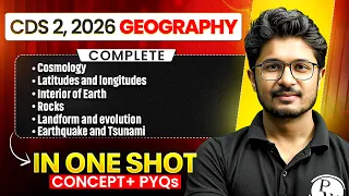
Geography: Complete Physical - CDS General Knowledge
14 views

CDS Wallah
Notes
Video Summary
Physical Geography: Latitudes, Longitudes, Earth's Interior, Rocks, and Landforms
Cloud Types and Key Features
Clouds are classified based on their appearance, altitude, and precipitation potential. Prefixes and suffixes in cloud names indicate their characteristics, such as height, shape, and rain-giving ability.
- Cirrus: High-altitude clouds, wispy in appearance.
- Alto: Middle-level clouds.
- Nimbus: Rain-giving clouds.
- Cumulus: Heap-shaped clouds with flat bases and dome-shaped tops.
- Stratus: Layered, horizontally extensive clouds.
- Nimbostratus: Rain-giving, layered clouds.
- Cumulonimbus: Vertically developed, rain and thunderstorm clouds, also called anvil-shaped clouds.
Latitudes and Longitudes: Definitions and Functions
Latitudes and…
Physical Geography: Latitudes, Longitudes, Earth's Interior, Rocks, and Landforms
Cloud Types and Key Features
Clouds are classified based on their appearance, altitude, and precipitation potential. Prefixes and suffixes in cloud names indicate their characteristics, such as height, shape, and rain-giving ability.
- Cirrus: High-altitude clouds, wispy in appearance.
- Alto: Middle-level clouds.
- Nimbus: Rain-giving clouds.
- Cumulus: Heap-shaped clouds with flat bases and dome-shaped tops.
- Stratus: Layered, horizontally extensive clouds.
- Nimbostratus: Rain-giving, layered clouds.
- Cumulonimbus: Vertically developed, rain and thunderstorm clouds, also called anvil-shaped clouds.
Latitudes and Longitudes: Definitions and Functions
Latitudes and longitudes are imaginary lines used to locate any point on Earth's surface. Latitudes run parallel to the equator, while longitudes run from pole to pole.
- Latitude: Measures north-south position from the equator (0°), which divides Earth into Northern and Southern Hemispheres.
- Longitude: Measures east-west position from the Prime Meridian (0°), which passes through Greenwich, England.
- Geographical Grid: The network formed by the intersection of latitudes and longitudes, enabling precise location identification.
Key Properties of Latitudes and Longitudes
Latitudes and longitudes have distinct properties regarding their orientation, spacing, and function.
- Latitudes:
- Parallel to each other.
- Distance between successive latitudes is nearly constant but slightly decreases towards the poles due to Earth's flattening.
- 0° latitude is the equator; 90°N and 90°S are the poles.
- Total: 181 latitudes (including equator and poles), 179 if poles are excluded.
- Indicate climate zones (Torrid, Temperate, Frigid).
- Longitudes:
- All are equal in length, converge at the poles.
- 0° longitude is the Prime Meridian; 180° is the Antimeridian (International Date Line vicinity).
- Total: 360 longitudes (179 east, 179 west, 0°, and 180°).
- Used to determine time zones.
Time Calculation and International Date Line
Earth rotates 360° in 24 hours, so each 15° longitude corresponds to a 1-hour time difference. The International Date Line (IDL) is an imaginary, zigzag line near 180° longitude, marking the change of calendar day.
- Time Calculation:
- 360° rotation = 24 hours.
- 15° longitude = 1 hour.
- 1° longitude = 4 minutes.
- Eastward movement: time increases; westward: time decreases.
- International Date Line:
- Crossing from west to east: subtract one day.
- Crossing from east to west: add one day.
- Zigzags to avoid dividing countries into different days.
Earth's Interior: Structure and Sources of Information
Earth's interior is divided into concentric layers: crust, mantle, and core. Information about these layers comes from direct and indirect sources.
- Direct Sources:
- Mining (limited to shallow depths).
- Volcanic material (lava samples).
- Indirect Sources:
- Seismic waves (P and S waves).
- Gravitational anomalies.
- Meteorite composition.
Seismic Waves and Shadow Zones
Seismic waves generated by earthquakes provide insights into Earth's internal structure. There are two main types: body waves (P and S) and surface waves (L and R).
- P (Primary) Waves:
- Travel through solids, liquids, and gases.
- Fastest, arrive first.
- Move in a push-pull manner.
- S (Secondary) Waves:
- Travel only through solids.
- Slower, arrive after P waves.
- Move in an up-and-down manner.
- Shadow Zones:
- S-wave shadow zone: 103° to 103° from the epicenter (do not pass through liquid outer core).
- P-wave shadow zone: 105° to 140° (due to refraction at core-mantle boundary).
Earth's Layers and Discontinuities
Earth's structure consists of the crust, mantle, and core, each with distinct composition and density. Discontinuities mark the boundaries between these layers.
- Crust: Outermost, solid, 5–70 km thick (thinner under oceans, thicker under continents).
- Mantle: Below crust, extends to 2900 km, contains most of Earth's volume and mass.
- Core: Innermost, from 2900 km to 6400 km, outer core is liquid, inner core is solid.
- Discontinuities:
- Conrad: Upper and lower crust.
- Mohorovičić (Moho): Crust and mantle.
- Repetti: Upper and lower mantle.
- Gutenberg: Mantle and core.
- Lehmann: Outer and inner core.
Composition and Density of Earth's Layers
Each layer has characteristic elements and density, increasing with depth.
- Crust: Rich in oxygen, silicon, aluminum, iron, calcium, sodium, potassium, magnesium.
- Mantle: Composed mainly of silicon and magnesium.
- Core: Composed mainly of nickel and iron (Nife layer).
- Density:
- Upper crust: 2.7 g/cm³
- Lower crust: 3 g/cm³
- Mantle: 5 g/cm³
- Outer core: 11 g/cm³
- Inner core: 15 g/cm³
Rocks: Types, Formation, and Characteristics
Rocks are aggregates of one or more minerals. They are classified based on their origin into igneous, sedimentary, and metamorphic rocks.
- Igneous Rocks:
- Formed by cooling and solidification of magma/lava.
- Intrusive (plutonic): Cooled inside Earth, large crystals (e.g., granite, gabbro).
- Extrusive (volcanic): Cooled on surface, fine crystals (e.g., basalt, pumice).
- Sedimentary Rocks:
- Formed by deposition, compression, and cementation of sediments.
- May contain fossils and show stratification.
- Types: Mechanically formed (sandstone), chemically formed (limestone), organically formed (coal, chalk).
- Metamorphic Rocks:
- Formed by transformation of igneous or sedimentary rocks under heat and pressure.
- Contact/thermal metamorphism: Due to heat.
- Dynamic metamorphism: Due to pressure.
- Foliated (layered): Slate, schist, gneiss.
- Non-foliated: Marble, quartzite.
Weathering and Erosion: Processes and Types
Weathering is the breakdown of rocks in situ, while erosion involves transportation of weathered material. Weathering is classified into physical, chemical, and biological types.
- Physical Weathering:
- Frost wedging: Water enters cracks, freezes, expands, and breaks rocks.
- Thermal expansion: Repeated heating and cooling causes expansion and contraction.
- Pressure release (exfoliation): Removal of overlying material causes expansion and peeling.
- Salt weathering: Salt crystallization in pores causes disintegration.
- Chemical Weathering:
- Solution: Minerals dissolve in water.
- Carbonation: Reaction with carbonic acid.
- Hydration: Absorption of water causes expansion.
- Oxidation: Reaction with oxygen (e.g., rusting).
- Reduction: Occurs in absence of oxygen, common in waterlogged areas.
- Biological Weathering:
- Plant roots grow into cracks.
- Animals burrow and disturb rocks.
- Lichens and mosses produce acids.
Landforms Created by Erosion and Deposition
Various agents (running water, groundwater, glaciers, wind, sea waves) create distinctive erosional and depositional landforms.
- Running Water:
- Erosional: V-shaped valleys, gorges, canyons, waterfalls, river terraces, meanders.
- Depositional: Alluvial plains, floodplains, natural levees, deltas, point bars, oxbow lakes.
- Groundwater:
- Erosional: Lapies, sinkholes, dolines, uvalas, caves, blind valleys.
- Depositional: Stalactites (hanging from ceiling), stalagmites (rising from floor), columns/pillars (when both meet), travertine.
- Glaciers:
- Erosional: Cirques, horns, arêtes, U-shaped valleys (glacial troughs), hanging valleys.
- Depositional: Moraines (lateral, terminal), drumlins, outwash plains, fjords (when sea water enters glacial valleys).
- Wind (Aeolian):
- Erosional: Yardangs (hard rock ridges), zeugens, deflation hollows, mushroom rocks, inselbergs.
- Depositional: Sand dunes (barchans, seifs, parabolic, transverse, longitudinal), loess (fine silt), erg (sea of sand).
- Sea Waves:
- Erosional: Cliffs, wave-cut platforms, sea arches, sea stacks, headlands.
- Depositional: Beaches, spits, bars, tombolos (connecting mainland to island), lagoons.
Climate Zones and Solar Energy Distribution
Latitudes determine climate zones and the amount of solar energy received. The equator receives perpendicular rays, while poles receive slanting rays.
- Torrid Zone: Between Tropic of Cancer (23.5°N) and Tropic of Capricorn (23.5°S), receives maximum heat.
- Temperate Zones: Between 23.5° and 66.5° in both hemispheres, moderate climate.
- Frigid Zones: Beyond 66.5° to the poles, coldest regions.
- Solar Energy:
- Equator: ~320 W/m²
- Poles: ~70 W/m²
Time Zones and Indian Standard Time (IST)
Time zones are based on longitudes, with each 15° representing one hour. Indian Standard Time is based on 82.5°E longitude.
- IST Calculation:
- Westernmost point: 68°7'E
- Easternmost point: 97°25'E
- Mean longitude: (68.1167 + 97.4167)/2 = 82.5°E
- IST is 5 hours 30 minutes ahead of GMT (Greenwich Mean Time).
- IST passes through Uttar Pradesh, Chhattisgarh, Madhya Pradesh, Andhra Pradesh, West Bengal, and Jharkhand.
Key Exam Points and Common Questions
Several factual points and typical exam questions are highlighted for quick recall.
- Venus: Hottest planet due to CO₂, yellowish clouds due to sulfuric acid.
- Origin Theories of Earth:
- Nebular Hypothesis: Laplace
- Interstellar Dust Hypothesis: Otto Schmidt
- Gaseous Hypothesis: Immanuel Kant
- Binary Star Hypothesis: Russell
- Planetesimal Hypothesis: Chamberlin & Moulton
- Big Bang Theory: Georges Lemaître (evidence by Edwin Hubble)
- Steady State Concept: Hoyle, Bondi, Gold
- Difference between Hypothesis and Theory:
- Hypothesis: Scientifically sound but not proven.
- Theory: Scientifically sound and proven.
- Twinkling of Stars: Due to atmospheric refraction.
- Tropic of Cancer in India: Passes through 8 states; 2 coastal (Gujarat, West Bengal), 6 landlocked.
- Longest Latitude: Equator (0°).
- IST States: Passes through Uttar Pradesh, Chhattisgarh, Madhya Pradesh, Andhra Pradesh, West Bengal, Jharkhand.
- Shadow Zone: S-wave shadow zone is larger than P-wave shadow zone.
- Rock Cycle: Rocks continuously change forms through weathering, erosion, deposition, melting, and metamorphism.
Table: Major Minerals in Earth's Crust (Ascending Order by Abundance)
| Mineral | Approximate % in Crust |
|---|---|
| Calcium | Least |
| Aluminum | |
| Silicon | |
| Oxygen | Most |
- Feldspar: Covers half of Earth's crust, light salmon pink, composed mainly of silicon and oxygen.
- Quartz: Major component of sand and granite, hard, insoluble in water.
- Pyroxene: Contains calcium, aluminum, magnesium, iron, silica; 10% of crust, found in meteorites.
- Amphibole: Contains aluminum, calcium, silicon, iron, magnesium; 7% of crust.
- Mica: Potassium, aluminum, magnesium, iron, silica; 4% of crust, found in igneous and metamorphic rocks.
- Olivine: Magnesium, iron, silica; green, found in basaltic rocks.
Endogenic and Exogenic Forces
Earth's surface is shaped by internal (endogenic) and external (exogenic) forces.
- Endogenic Forces: Originate within Earth, responsible for mountain building, earthquakes, volcanism; called land-building forces.
- Exogenic Forces: Originate from atmospheric processes (sunlight, rainfall, wind), responsible for weathering, erosion, mass movement, and deposition; called land-leveling forces.
Weathering, Mass Movement, and Erosion
Exogenic processes are divided into weathering, mass movement, erosion, and deposition.
- Weathering: Physical, chemical, biological breakdown of rocks.
- Mass Movement: Downslope movement of soil and rock (rapid: landslides, earthflows; slow: soil creep).
- Erosion: Removal and transport of material by water, wind, glaciers, sea waves.
- Deposition: Accumulation of transported material, forming various landforms.
Special Landforms and Features
- Karst Topography: Formed by groundwater action in limestone regions; features include lapies, sinkholes, dolines, uvalas, caves, stalactites, stalagmites.
- Glacial Features: Cirques, horns, arêtes, U-shaped valleys, hanging valleys, moraines, drumlins, fjords.
- Aeolian Features: Yardangs, zeugens, deflation hollows, mushroom rocks, inselbergs, sand dunes (barchans, seifs, parabolic, transverse, longitudinal), loess, erg.
- Marine Features: Cliffs, wave-cut platforms, sea arches, sea stacks, headlands, beaches, spits, bars, tombolos, lagoons.
Exam-Oriented Quick Facts
- IST is 5.5 hours ahead of GMT, based on 82.5°E longitude.
- Equator receives maximum solar energy; poles receive minimum.
- Tropic of Cancer passes through 8 Indian states; 2 coastal, 6 landlocked.
- Venus: Hottest planet due to CO₂, yellowish clouds from sulfuric acid.
- Shadow zone for S-waves is larger than for P-waves.
- Feldspar is the most abundant mineral in Earth's crust.
- Twinkling of stars is due to atmospheric refraction.
- Difference between weathering and erosion: Weathering is in situ breakdown; erosion involves transportation.
- Contact metamorphism: Due to heat; dynamic metamorphism: Due to pressure.
- Rock cycle: Rocks change forms through weathering, erosion, deposition, melting, and metamorphism.
Quiz
40 QuestionsClick on an option to find the answer
Question 1 of 40
Consider the following statements:
Understanding phenomena such as earthquakes and volcanoes Exploring resources and minerals Tracing the evolution of the atmosphere Investigating magnetismHow many of the above are the reasons behind studying earth’s interior?
Solution
All four
Which one of the following best describes the term "Petrology" sometimes seen in the news?
Solution
The study of rocks and their classification based on mineral composition and formation
Solution
Flashcards
14 CardsClick to reveal answerTap the card to see answer

